Day 28. Thursday, 25
July. Taos to Carlsbad, New Mexico. 2 hours, 10 minutes - IFR.
It was a fine-weather flight apart from the descent through rain showers. The
ceiling was only 700 feet above the runway at Carlsbad City and it was pouring with rain
on arrival. We ran to the terminal, hired a car and headed for White's City. Hardly a city
- more like a collection of motels, chain restaurants and gift shops. Light entertainment
is provided at a small theatre called Granny's Opera House. Although we were still in the
State of New Mexico, no alcoholic beverages were to be had at lunch time. We ate tacos at
a self-service and drove to the caverns.
The caverns were awesome both in size and beauty. Our three-hour walk took us through
numerous chambers filled with a myriad of natural sculptures in the form of stalagmites,
stalactites and what the Americans call "soda straws" and "popcorns".
After an early dinner we returned to the caverns to watch the bat flight. About 250,000
bats live at the entrance to the caves and fly out at night in search of food. While we -
and countless other tourists - waited for the bats to appear, a lecture was given by a
park ranger who looked a bit like a bat herself! The large audience seated in an
amphitheatre near the cave's entrance was becoming quite bored and impatient by the time
the bats finally made their appearance. They were smaller than I had expected, but their
quantity made up for their size. Circling around at the cave exit to gain enough height to
clear the cliff top, they reminded me of similar experiences in the Mooney bird.
Day 29. Friday, 26 July. Carlsbad to Holbrook, Arizona. 2 hours 48 minutes - IFR.
We departed IFR due to weather at Carlsbad, but it soon cleared and there were
no challenges for Flemming (poor thing!).
In Holbrook, it was hot. We ate a hot dog and drank Corona beer in a dark, sleazy saloon
bar, frequented by cowboys in ten gallon hats (yes, they still exist) before driving to
the Petrified Forest National Park in our air conditioned limousine. The park's main
attraction is the thousands of logs of 200 million year old petrified wood that became
exposed due to erosion. It also features a "Painted Desert" and hills or
"badlands" composed of different layers of sediment with varying colours. The
whole effect is spectacular.
Day 30. Saturday, 27 July. Holbrook to Blanding, Utah, via Monument Valley. One hour 19
minutes - VFR.
After a hearty American breakfast of eggs, bacon and pancakes with maple syrup,
we took off for Blanding. There wasn't a cloud in the sky... just a lot of thermals! I
wasn't enjoying the bumpy ride until we reached Monument Valley which was so outstanding
that I forgot to be anxious.
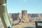
This valley, with its tall, often slim, rock formations jutting out of the earth like
totem poles, is so photogenic that it was used for one of the Marlboro adverts. Flying
alongside these natural sculptures was a breathtaking experience which could not be
equaled from the ground, as we discovered when we drove there later in the day.
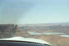
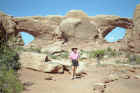
Day 31. Sunday, 28 July. Blanding to Moab, Utah, via Canyonlands National Park. 36
minutes - VFR.
There was little turbulence in spite of the scorching hot weather and flying
over Canyonlands was an experience only to be rivaled by Monument Valley. We drove to
Arches National Park in an air conditioned car. It was hot - in the 100s - dry, and dusty.
Thankfully, many of the interesting rock formations could be seen from our car seat. We
reserved our walks to the less accessible arches for the 2 hours before sunset.
Day 32. Monday, 29 July. Moab to Bryce Canyon, Utah. One hour, 7 minutes - VFR.
We made a short drive to Canyonlands before leaving for Bryce. There were some
splendid views but you need a four-wheel drive vehicle if you want to descend into the
valleys below the high plateau. Perhaps we'll return one day to do some rafting along the
Colorado river.
It was after midday when we took off for Bryce and we knew we could run into thunderstorms
on the way. However, we "sidestepped" neatly around the CBs and, although the
sky looked threatening over Bryce and the wind was gusty, we landed without mishap. At
7,600 feet, Bryce was the highest airport of the trip and the air temperature was
pleasantly in the 80s. It was good to see plenty of green trees again.
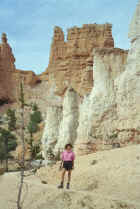
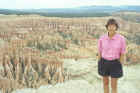
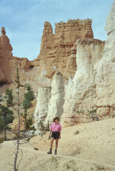
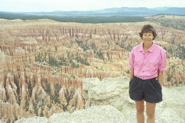
Day 33. Tuesday, 30 July. Bryce Canyon.
There are many hiking trails in the park. We chose the Fairyland Loop Trail, a
five-hour walk in a magic world of pink columns which owe their existence to erosion.
However, the Canyon's magic seems to have been lost on Ebenezer Bryce who raised livestock
there in the 19th century. He just said "It's a helluva place to lose a cow."
Day 34. Wednesday, 31 July. Bryce Canyon to Palo Alto, California. 3 hours 35 minutes -
VFR.
We took off early, not just to avoid thunderstorms, but to get airborne before
it got too hot. Actually, it was 25 C at take-off. That, coupled with the 7600 feet
elevation of Bryce Canyon, translates into a 10,400 feet density altitude. Flemming says
"Don't take off in a fully loaded Cherokee 140 or Cessna 150! It won't work, even
with a runway more than 7000 feet long." In fact, a guy in a Cherokee 140 had crashed
on take-off just two weeks previously.
Flemming calculated that we'd need most of the length of the runway to take off and he was
proved right (as usual!). But besides the take-off, the last leg of our odyssey can only
be described as an anti-climax. There was not a thunderstorm in sight even when we flew at
14,500 feet over the Sierra Nevada mountains.
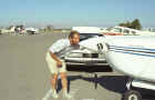
My first feeling on landing in Palo Alto was one of relief at having finally reached our
destination. It would be nice to sleep in the same bed for more than a night or two...
Then we saw all the other little planes parked on the apron: nearly 600 of them!
At peak departure and arrival times the sky is thick with small Cessnas. You need eyes all
over your head, a fast reaction to get a word in on the radio, and the controllers spit
out their messages like machine-guns... but this is the pilot's paradise of sunny
California! |
Click on image to enlarge,
click browser back to return 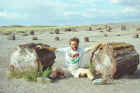
Petrified Forest National Park
|

